Trail Map
Download a Trail Map (pdf)
Trails
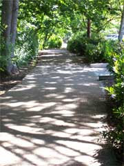
Cox Creek Loop/Waverly Lake Loop
From Waverly Lake Loop on the east side of the bridge over Cox Creek, cross Old Salem road and follow the creek to Waverly Street and back.
- 0.65 miles down and back Cox Creek trail
- 1.35 miles Waverly and the Cox Creek trail
 Dave Clark Trail
Monteith Park to Bowman Park. Paved trail runs along the south side of the Willamette River. You will see firsthand the beginning steps of redevelopment of historically industrial property to mixed use housing and retail on Albany's waterfront. The trail opens up onto residential Front Avenue which leads to Geary Street and the entrance to Bowman Park. Distance: 1.5 miles each way (3.0 round trip)
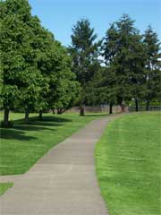
Lexington Park
Path running along the perimeter of the park is 5000' or 95% of a mile (a mile being 5280')
Oak Creek Greenbelt Trail
A soft surface trail that connects Teloh Calapooia Park with the Calapooia River and neighborhoods to the north. Distance: 1.8 miles
Periwinkle Creek Trail
A paved, flat bicycle and pedestrian path that runs along Periwinkle Creek from the northwest corner of Grand Prairie Park to the Albany Boys and Girls Club.
- Grand Prairie Park to 21st Street - .87 miles
- Grand Prairie Park to Queen Ave - 1.15 miles
- Grand Prairie Park to Boys and Girls Club - 1.8 miles
- Grand Prairie Park/ Boys and Girls Club/ Grand Prairie (Round Trip) - 3.61 miles
Simpson Park Trail
Starting from the parking lot and continuing until the path ends in a grassy area with one very narrow path heading back toward the river. Dirt path. Distance: 2.36 miles down and back
Swanson Park Connector
Proposed paved path on the north side of highway 99 that connects Swanson Park with the nearby Amtrak/Transit Center. Distance: .35 mile
Takena Landing Trail
A soft surface path running on the north side of the Willamette River. Trail starts at the boat landing and heads to the east. As you travel down the trail the sounds of the city gradually give way to the rhythmic sounds of the river. The end of the trail loops back and allows you to return the way you came. Distance: 1.5 miles each way
Timber Linn Park
A paved path from Timber Linn parking lot to highway 20 and back along airport side of Price road to the crosswalk at the fairgrounds and back to the parking lot. Distance: 1.47 miles
Waverly Lake Loop
This paved path starts at the parking lot, and follows the banks of Waverly Lake. Distance: .70 miles
*All Distances Approximate


